Autumnal equinox has passed, autumn is thick, in addition to the weather gradually turned cool, the air has become drier, especially in the forest area of outdoor facilities and equipment, such as pylons, overhead lines, etc., "fire prevention" in accordance with the customary was mentioned.
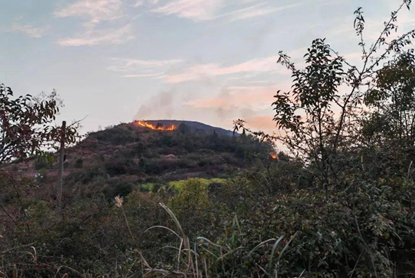
We look at the specifics: fall, especially in late fall, due to reduced precipitation, falling temperatures, trees, shrubs and other plants gradually lose moisture, becoming extremely flammable. In addition, the leaves piled up on the ground, forming a thick layer of "fuel", coupled with the fall tour, wild fishing and other outdoor activities also increase the chances of man-made carry fire; In addition, the current is in the peak of the crop harvest, many people in order to prepare for the next season's planting, burning straw in the fields, which are easy to lead to hill fires, These are all factors that lead to the occurrence of hill fires, which seriously threaten the safe and stable operation of power transmission lines.
What are the specific risks faced? Apart from the possibility of causing power tower materials to expand or contract due to temperature changes, resulting in structural loosening or damage, soot, ash and other substances generated by hill fires will adhere to insulators under the action of wind, forming a layer of dirt that is difficult to remove. In addition, even transmission lines that are not directly damaged may experience increased wire arc sag due to high temperatures, shortening the safe distance from the ground or surrounding vegetation and increasing the risk of subsequent failures.
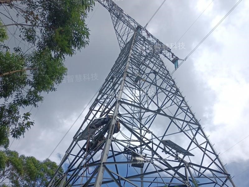
To cope with the challenges brought by the high incidence of hill fires in fall, DX-Wisdom has developed a transmission line Anti-mountain fire online monitoring deviceDX-WPS100-SH. The device is equipped with a dual-spectrum PTZ dome, which can collect infrared and visible light image video of the line, and utilize the video analysis and processing technology and flame temperature detection technology to monitor, identify smoke, and detect flames on the target. monitoring, smoke identification, flame identification, hill fire localization, and upload hill fire information wirelessly to the monitoring center.
Key Features
1, panoramic scanning: can be a radius of 3km range, horizontal 360 °, vertical ± 60 ° for all-round scanning, scanning cycle of no more than 10 minutes (adjustable), detection accuracy of not less than 2 × 2 square meters of fire area;
2, AI identification: support for hill fire and smoke intelligent identification, expandable construction machinery (cranes, tower cranes, excavators, dump trucks, bulldozers and cement pumps), tree barriers, floating objects and other intelligent identification needs, hidden danger pictures real-time transmission back to the monitoring center;
3、Online monitoring: 24-hour uninterrupted video recording, local storage of video, alarm triggered, you can immediately intercept the length of not less than 20s short video, and automatically uploaded to the main station. Timed photo: upload 1 photo of the scene at regular intervals;
4, fire point localization: using Beidou + 3D point cloud, to get the fire latitude and longitude;
Remote control: It can realize remote zoom, direction adjustment, preset position setting and other PTZ control functions, as well as remote query/setting parameters, data summoning, remote reset, remote timing and other functions.
technical specification
1, thermal imaging resolution: ≥ 384 * 288
2、Video pixels: 2 million
3、Optical zoom: 30 times
4、Power supply: solar + lithium battery
5、Protection grade: IP66


